Under Moldova’s regional administrative organization law, it is administratively divided into the following administrative district units: districts, cities / towns and villages.
The administrative divisions of Moldova is organized at 2 levels:
- Villages, sectors and cities / towns constitute the first level.
- Districts, Chișinău municipality, Bălți municipality and Bender municipality constitute the second level.
Two or more villages can form a community together. With these criteria, Moldova consists of 32 districts, three municipalities and two autonomous territorials.
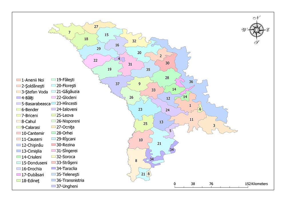
Administrative divisions of Moldova consist of 32 districts, three municipalities and two autonomous territorials.
The three municipalities in Moldova are:
- Chișinău,
- Bălți and
- Bender.
Two autonomous regions are Gagauzia and Transnistria.
Thirty-Two Districts of Moldova
The 32 districts located in Moldova are:
- Anenii Noi
- Basarabeasca
- Briceni
- Cahul
- Cantemir
- Călărași
- Căușeni
- Cimișlia
- Criuleni
- Dondușeni
- Drochia
- Dubăsari
- Edineț
- Fălești
- Florești
- Glodeni
- Hîncești
- Ialoveni
- Leova
- Nisporeni
- Ocnița
- Orhei
- Rezina
- Rîșcani
- Sîngerei
- Soroca
- Strășeni
- Șoldănești
- Ștefan Vodă
- Taraclia
- Telenești
- Ungheni
Anenii Noi
The Anenii Noi District is a district in the central region of Moldova. The area is 892 square kilometers.
The population of the region is 78,996 as of 2014 and the population density is 89 / square kilometers.
Basarabeasca
Basarabeasca District is a district in the southern region of Moldova. The area is 295 square kilometers. As of 2014, the population of the region is 23,012 and the population density is 78 / square kilometers.
Briceni
Briceni District is a district in the north-west region of Moldova. The area of the region is 814 square kilometers. As of 2014, the population of the region is 70,029 and the population density is 86 / sq. Km.
Cahul
Cahul District is a district in the southern region of Moldova. The area of the region is 1,546 square kilometers. As of 2014, the population of the region is 105,324 and the population density is 68 / square kilometers.
Cantemir
Cantemir District is a district in the south of Moldova. The area is 870 square kilometers. The population of the region is 52,115 as of 2014 and the population density is 60 / sq. Km.
Călărași
Călărași District is a district in the central region of Moldova. The area of the region is 753 square kilometers. As of 2014, the population of the region is 64,401 and the population density is 86 / sq. Km.
Căușeni
Căușeni District is a district in the central region of Moldova. The area of the region is 1,163 square kilometers. The population of the region is 81,185 as of 2014 and the population density is 70 / square kilometers.
Cimișlia
Basarabeasca District is a district in the southern region of Moldova. The area of the region is 923 square kilometers. As of 2014, the population of the region is 49,299 and the population density is 53 / square kilometers.
Criuleni
Criuleni District is a district in the central region of Moldova. The area is 688 square kilometers. As of 2014, the population of the region is 70,648 and the population density is 100 / square kilometers.
Dondușeni
Dondușeni is a district in the northern part of Moldova. The area of the region is 645 square kilometers. As of 2014, the population of the region is 37,856 and the population density is 59 / sq km.
Drochia
Drochia District is a district in the northern part of Moldova. The area is 1,000 square kilometers. As of 2014, the population of the region is 74,443 and the population density is 74 / square kilometers.
Dubăsari
The Dubăsari District is a district in the eastern part of Moldova. The area is 309 square kilometers. As of 2014, the population of the region is 29,271 and the population density is 95 / km2.
Edineț
The Edineț District is a district in the north-west of Moldova. The area is 933 square kilometers. The population of the region as of 2014 is 71,849 and the population density is 77 / sq km.
Fălești
Fălești District is a district in the northern part of Moldova. The area is 1,073 square kilometers. As of 2014, the population of the region is 78,258 and the population density is 73 / square kilometers.
Florești
Florești District is a district in the north-east of Moldova. The area is 1,108 square kilometers. The population of the region is 76,457 as of 2014 and the population density is 69 / sq km.
Glodeni
The Glodeni District is a district in the northwestern region of Moldova. The area of the region is 754 square kilometers. The population of the region is 51,306 as of 2014 and the population density is 68 / sq km.
Hîncești
Hîncești District is a district in the western part of Moldova. The area of the region is 1,484 square kilometers. As of 2014, the population of the region is 103,784 and the population density is 70 / square kilometers.
Ialoveni
Ialoveni District is a district in the central region of Moldova. The area of the region is 783 square kilometers. The population of the region is 93,154 as of 2014 and the population density is 120 / square kilometers.
Leova
The Leova District is a district in the central region of Moldova. The area is 775 square kilometers. The population of the region is 44,702 as of 2014 and the population density is 58 / sq km.
Nisporeni
Nisporeni District is a district in the western-central region of Moldova. The area is 630 square kilometers. As of 2014, the population of the region is 53,154 and the population density is 84 / square kilometers.
Ocnița
The Ocnița District is a district in the northern part of Moldova. The area is 597 square kilometers. As of 2014, the population of the region is 47,425 and the population density is 79 / sq. Km.
Orhei
The Orhei District is a district in the central region of Moldova. The area of the region is 1,228 square kilometers. As of 2014, the population of the region is 101,502 and the population density is 83 / square kilometers.
Rezina
The Rezina District is one of the 37 administrative divisions of Moldova.. The area is 621 square kilometers. As of 2014, the population of the region is 42,486 and the population density is 68 / square kilometers.
Rîșcani
The Rîșcani District is a district in the north-west of Moldova. The area of the region is 936 square kilometers. As of 2014, the population of the region is 59,226 and the population density is 63 / km2.
Sîngerei
Sîngerei District is a district in the northern part of Moldova. The area is 1,033 square kilometers. As of 2014, the population of the region is 79,814 and the population density is 77 / square kilometers.
Soroca
The Soroca District is a district in the north-east region of Moldova. The area is 1,043 square kilometers. As of 2014, the population of the region is 77,656 and the population density is 74 / square kilometers.
Strășeni
The Strășeni District is one of the 37 administrative divisions of Moldova.. The area is 730 square kilometers. As of 2014, the population of the region is 82,675 and the population density is 110 / square kilometers.
Șoldănești
Șoldănești District is a district in the north-east of Moldova. The area is 598 square kilometers. As of 2014, the population of the region is 36,743 and the population density is 61 / km2.
Ștefan Vodă
Eftefan District is a district in the south-east of Moldova. The area is 998 square kilometers. As of 2014, the population of the region is 62,072 and the population density is 62 / square kilometers.
Taraclia
Taraclia District is one of the 37 administrative divisions of Moldova. The area is 674 square kilometers. The population of the region is 37,357 as of 2014 and the population density is 55 / km2.
Telenești
Telenești District is a district in the central region of Moldova. The area is 849 square kilometers. The population of the region is 61,144 as of 2014 and the population density is 72 / square kilometers.
Ungheni
Ungheni District is a district in the southern region of Moldova. The area is 1,083 square kilometers. As of 2014, the population of the region is 101,064 and the population density is 93 / square kilometers.
Three Municipalities of Moldova

The three municipalities in Moldova are Chișinău, Bălți and Bender.
Chișinău
Chisinau is the capital and largest city of the Republic of Moldova. Chisinau is one of the cities with plenty of green space in Europe, it is also an important trade and industrial center.
Located on the banks of the Bic River, a tributary of the Dniester River, the city has five districts. According to 2017 figures, the city has 685,900 inhabitants and a surface area of 120 square kilometers. The population density of Chisinau is 549.19 square kilometers.
Bălți
Bălţi is the second-largest city in the Republic of Moldova. The name means “slime.” Bălţi, one of the cities with plenty of green space in Europe, is also an important trade and industrial center.
Located on the banks of the river Răut, a branch of the Dniester River, the city has five districts. The city consists of an area of 78 km². Since 2014, the municipality has a population of 102,457.
Bender
Bender has been under the control of the Republic of Transnistria, which has not been recognized since 1992, but is internationally linked to the Republic of Moldova.
The city is located in the Transnistria region, east of the Dniester river. Under the laws of Moldova, the city is a separate municipality from the surrounding villages and the Transnistria.
The city of Bender was located in the buffer zone established at the end of the Transnistria War. The Transnistria has de facto administrative management in the city, while the Joint Control Commission has predominant forces. The city has an area of 97.29 square kilometers and the population of the city is 91,000 as of 2015.
Two Autonomous Territorial of Moldova
Moldova has two autonomous territorials. These regions; Gagauzia and Transnistria.
Gagauzia
Gagavuzia is an autonomous state of the Republic of Moldova. Gagauzia has a very high agricultural potential due to its fertile soil. The agricultural sector meets the raw material needs of the food and agriculture based industry.
Most of the working age population of the region is employed in this sector, and the basis of the socio-economic development of Gagauzia is based on agriculture. As of 2014, the area has a population of 1,832 and a population of 134,535 and a population density of 73.43 / square kilometers.
Transnistria
Transnistria is an official administrative division established to define the territory controlled by Pridnestrovian Moldavian Republic, which is not recognized by the Government of Moldova.
There are 147 settlements in Transnistria. The area of the region is 4,163 square kilometers. As of 2014, the population of the region is 505,153 and the population density is 124.6 / sq km.
Geography, Facts
- Population: 4,034,670
- Population Density: 123 per Km2
- Land Area: 32,850 Km ²
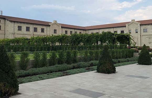
Moldova, known for its hanging gardens and world-famous wines, is one of the poorest countries in Europe. The capital is Chisinau. The city, which draws attention with its historical structure and architecture, is one of the most visited cities in the country. Moldovan, a dialect of Romanian, is the official language of the country.
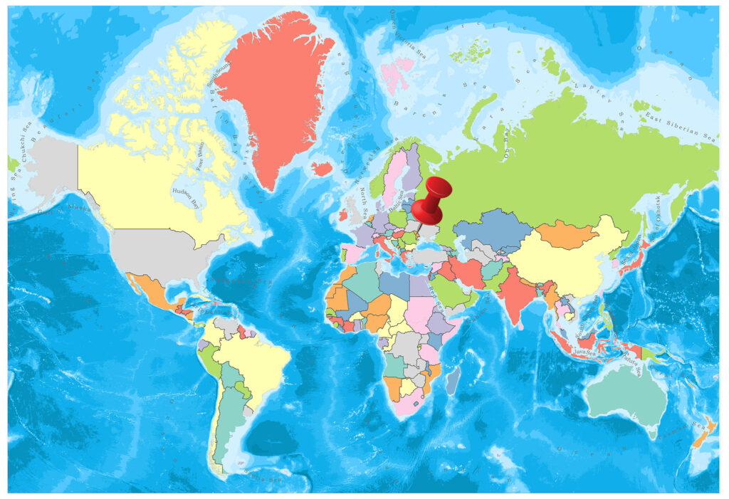
It is located in Eastern Europe. The border neighbors are Ukraine and Romania.
Geography
The hills south of the Carpathian mountains and the territory divided by the arms of the river Dnyestr dominate the geography of the country. The average altitude does not exceed 150 meters, the highest peak is Mount Balenesti.
Governance
Moldova is a democratic republic governed by a parliamentary system. There is a multi-party political structure in the country. Legislative authority belongs to the parliament. The legislation, executive and judiciary are independent.
Climate
A temperate and rainy land climate prevails. The winters are warm, the summers are hot.
Religion
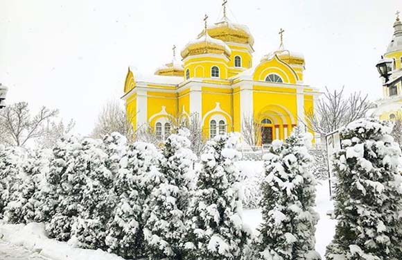
The Eastern Orthodox population is predominant in the country as a whole. There is a 1.5 percent Jewish belief.
Industry and Tourism
Effective soils, agriculture, and animal husbandry are increasing in importance. There is machine farming all over the farms. In the valleys, hillsides have dense fruit gardens and hazelnut plantations. Sugar beet, wheat, corn, sunflower, potatoes, vegetables, fruit; milk and eggs are the leading agricultural and animal products. In the north, cattle and pigs are grown. Wine, woven and metallurgy are the main industrial activities, especially the food. Phosphorus, lignite, tin, chips are the main underground resources.
Chisinau has one of the most vibrant nightlife in Europe, attracting a lot of tourists every year. Apart from nightlife, the country also attracts tourists with wine tourism and cultural tourism.
Art
In recent years, art branches like video-art, kinetic sculpture, computer graphics, tattooing, and performance have become very popular in Moldova. There are rich types of folk arts. Most are decorative arts. These are arts, such as ceramics, public carpet weaving, traditional costumes, stone and woodwork, leather products, metalworking, public toys.
Sports
Moldova’s national sport is wrestling. Apart from wrestling, football and rugby are also popular sports.