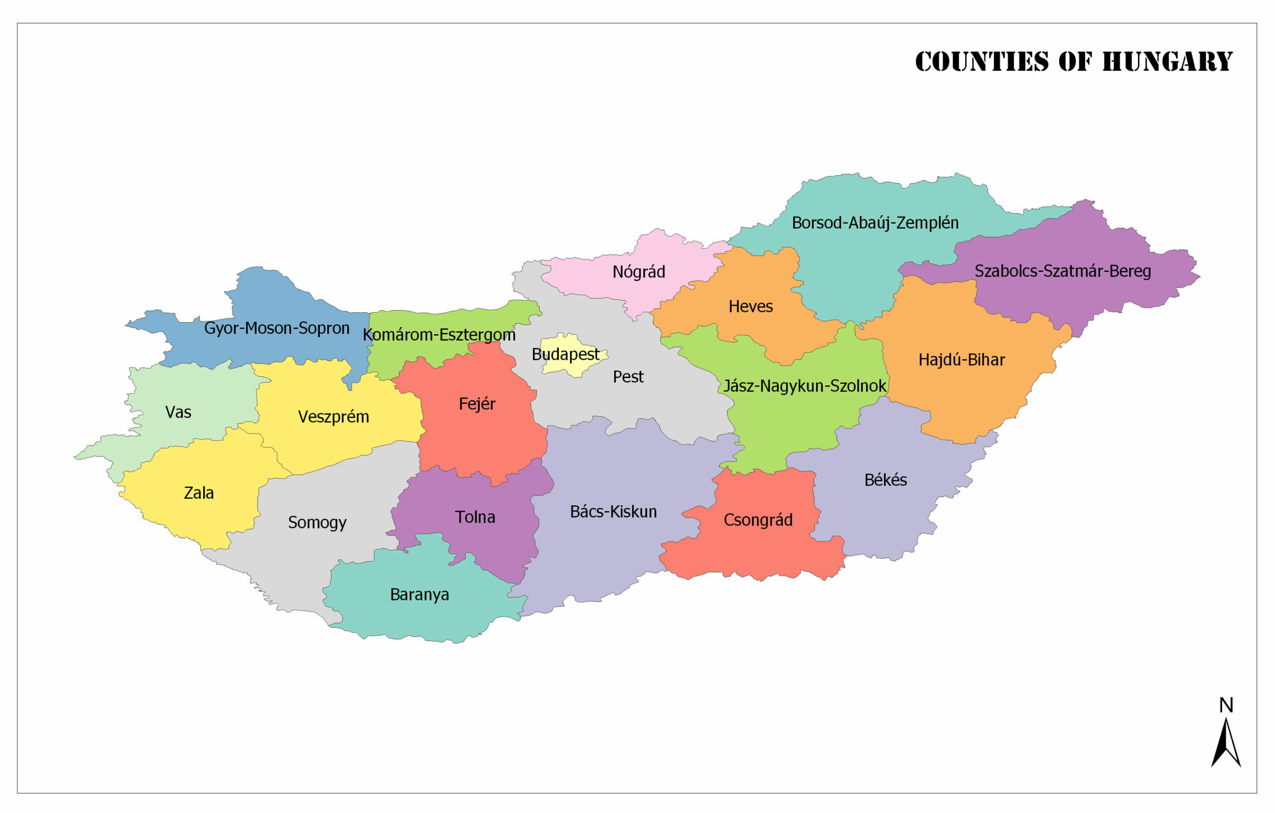
There are a total of 19 counties in Hungary, plus the capital city, Budapest.
Counties are also further divided into districts and then municipalities. In Budapest, for example, there are 23 districts. In this post, we’ll explore some cursory information on each of the counties of Hungary, such as size and population. Population data is based on estimates from 2019.
Below, you’ll find a map detailing the boundaries of each region in Hungary.
Counties of Hungary Map
Counties of Hungary:
Baranya
- County Seat: Pécs
- Total Land Area: 4,430 square kilometers (1,710 square miles)
- Population: 360,704
- Number of Districts: 10
Baranya is the southernmost county in Hungary, bordering Croatia and three other Hungarian counties. There are a range of geographical features in this county: mountains and forests in the northern portion, hills in the center of the county, and mostly flat land in the east and west of Baranya.
The county seat of Baranya is Pécs, which is Hungary’s fifth-largest city and lies near to the border with Croatia. It is one of the major cultural centers in the country and is also home to Hungary’s oldest university.
Bács-Kiskun
- County Seat: Kecskemét
- Total Land Area: 8,445 square kilometers (3,261 square miles)
- Population: 503,825
- Number of Districts: 11
This is the biggest county in Hungary, and it lies in the south of the country along the Serbian border. The county is mostly flat and includes the greatest area of Kiskunság National Park, which is listed as a UNESCO biosphere reserve.
Kecskemét is the county seat of Bács-Kiskun. The site of the city has been inhabited for a long time — the oldest pieces of evidence of human presence in the region are around five thousand years old. Today, the city is populated by a large Hungarian majority, with smaller populations of Romani, German, Slovak, and others totaling less than 5% of the city’s population.
Békés
- County Seat: Békéscsaba
- Total Land Area: 5,630 square kilometers (2,174 square miles)
- Population: 334,264
- Number of Districts: 9
Occupying the southeastern corner of Hungary is the county of Békés. It borders three other Hungarian counties as well as Romania. The name of this county comes from a castle that was established by Hungarians once they had conquered the area, and it means “peaceful.”
The seat of this county is Békéscsaba, which is located on the Great Hungarian Plain. It’s in an area that has been inhabited by humans for thousands of years, and many different peoples have conquered the area at different times: the Scythians, Celts, Huns, and Ottomans, to name a few.
Borsod-Abaúj-Zemplén
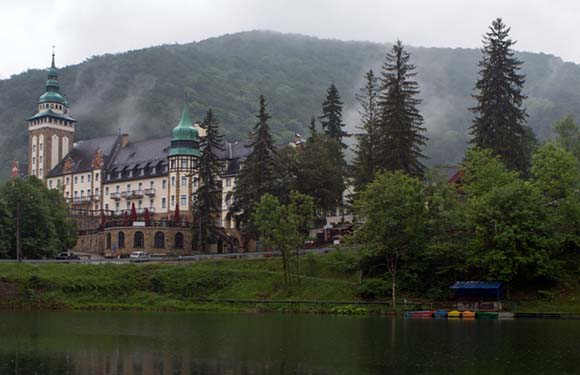
- County Seat: Miskolc
- Total Land Area: 7,247 square kilometers (2,798 square miles)
- Population: 642,447
- Number of Districts: 16
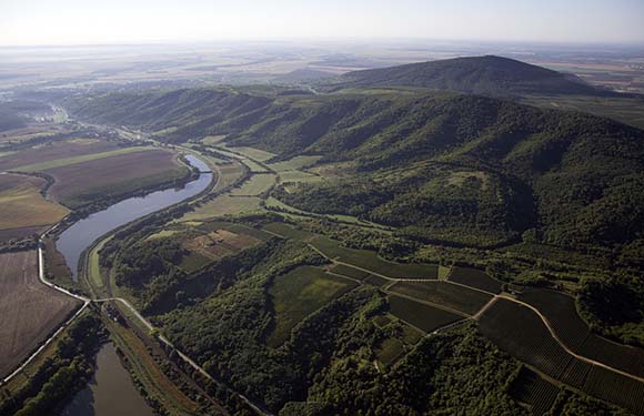
Borsod-Abaúj-Zemplén is Hungary’s northernmost county, bordering Slovakia to the north as well as four other Hungarian counties. It is the second-largest county in the country by size and population. Another notable feature of this county is that it is the only to host two UNESCO World Heritage Sites within its borders: the Caves of Aggtelek Karst and Slovak Karst and the Tokaj Wine Region Historic Cultural Landscape.
Miskolc is the county seat of Borsod-Abaúj-Zemplén and the fourth-largest city in Hungary. Economically, the city is best known for its industrial production. The infrastructure for heavy industry was largely developed during the Socialist era.
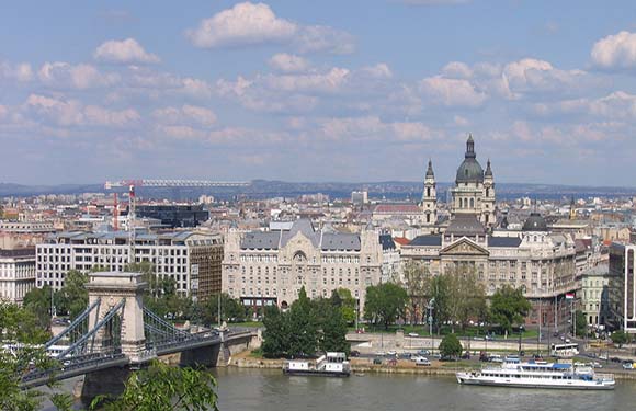
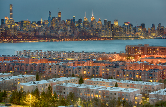
Budapest
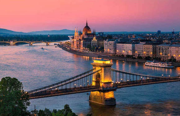
- County Seat: Municipality of Budapest
- Total Land Area: 525 square kilometers (203 square miles)
- Population: 1,752,286
- Number of Districts: 23
What county is Budapest in? That question doesn’t have an easy answer: unlike the other regions on this list, the Municipality of Budapest has special status as the capital of Hungary. It is not a county, but rather a municipality that effectively has the same status as one of the other 19 counties. It is the most populous administrative region in Hungary as well as the smallest in size, and it has 23 districts — more than any other county.
The city of Budapest is divided by the Danube River, which passes through the city and divides the former cities of Buda and Pest. It is the ninth-largest city in the European Union and the financial and political capital of Hungary.
Csongrád
- County Seat: Szeged
- Total Land Area: 4,263 square kilometers (1,646 square miles)
- Population: 399,012
- Number of Districts: 7
In the southeast of Hungary, this county borders the neighboring countries of Romania and Serbia in addition to three other domestic counties. The county is mostly flat and is the most important agricultural area of the country. This is because of the presence of high quality soil and an abundance of sunlight.
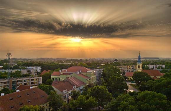
Szeged is the seat of the county, and it is the third-largest city in Hungary. It’s been inhabited since ancient times, and the first written record of its current name appears in a document written by King Béla III in 1183.
Fejér
- County Seat: Székesfehérvár
- Total Land Area: 4,358 square kilometers (1,683 square miles)
- Population: 417,712
- Number of Districts: 8
Fejér is a county in central Hungary that borders six other counties but has no foreign borders. Lakes, mountains, and plains in the area give the county geological diversity. One notable feature of this county is Lake Velence, which is a popular vacation location for Hungarians.
The county seat of Fejér is Székesfehérvár, which held an important role as a capital of the Kingdom of Hungary during the Middle Ages and as a royal residence. It is where the first Kings of Hungary were crowned and buried, and it was connected to trade routes that led to Italy, the Balkans, Budapest, and Vienna.
Győr-Moson-Sopron
- County Seat: Győr
- Total Land Area: 4,208 square kilometers (1,625 square miles)
- Population: 467,144
- Number of Districts: 7
In the northwestern corner of Hungary lies the county of Győr-Moson-Sopron, which borders Austria, Slovakia, and three other counties. The present-day borders of this county were established in 1950 and came about as the combination of the Győr-Moson and Sopron counties.
Located halfway between Budapest and Vienna is Győr, the county seat of Győr-Moson-Sopron. It is an important city in the northwestern region of Hungary and is well connected to the rest of Central Europe. One of the main contributors to Győr’s local economy is a large Audi automotive factory.
Hajdú-Bihar
- County Seat: Debrecen
- Total Land Area: 6,210 square kilometers (2,398 square miles)
- Population: 527,989
- Number of Districts: 10
This county borders Romania and four other counties in eastern Hungary. It was created after World War II as a combination of the Hajdú and Bihar counties. The region is mostly flat, though there are a variety of geographical features found in different areas of the county.
After Budapest, the largest city in Hungary is Debrecen, which is the seat of this county. It was the largest city in the country in the 18th century and is still one of the most important cultural locations in Hungary.
Heves
- County Seat: Eger
- Total Land Area: 3,637 square kilometers (1,404 square miles)
- Population: 294,609
- Number of Districts: 7
Heves is a county in the north of Hungary that borders four counties and has no foreign borders. It is one of the most geographically diverse counties in Hungary, with two of the tallest mountain ranges and a section of the Great Hungarian Plain within its borders. The largest artificial lake in Hungary, Lake Tisza, lies along the southern border of Heves.
The county seat of Heves is Eger, a city best known for its thermal baths, baroque buildings, red wines, and the Eger minaret, an Ottoman-era construction.
Jász-Nagykun-Szolnok
- County Seat: Szolnok
- Total Land Area: 5,582 square kilometers (2,155 square miles)
- Population: 370,007
- Number of Districts: 9
Jász-Nagykun-Szolnok is a county in central Hungary that borders seven others and no foreign countries. The names of this county come from the various peoples that settled in the area as well as the city of Szolnok, which is the seat of the county.
The city of Szolnok was a vital center for cultural and economic trade for centuries because of its location in the center of the Great Hungarian Plain. The immediate area around Szolnok is one of the sunniest in Europe.
Komárom-Esztergom
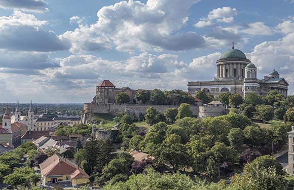
- County Seat: Tatabánya
- Total Land Area: 2,264 square kilometers (874 square miles)
- Population: 299,207
- Number of Districts: 6
The Komárom-Esztergom county is located in the north of Hungary, and its northern border is traced by the Danube River, which separates Hungary from Slovakia. The county also borders four others in Hungary.
The seat of this county is Tatabánya, which lies in the valley between Gerecse and Vértes Mountains. Since it is surrounded by mountains, the city is a junction for railroads and roads.
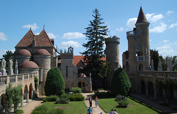
Nógrád
- County Seat: Salgótarján
- Total Land Area: 2,544 square kilometers (982 square miles)
- Population: 189,304
- Number of Districts: 6
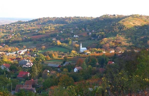
Nógrád is located in northern central Hungary and borders Slovakia as well as three other Hungarian counties. This is the least populated county in the country and the second-smallest by size. There are three mountain ranges that occupy part of this county, and the small villages can be found in valleys throughout the area.
The seat of this county is Salgótarján, which is located at the base of Karancs Mountain. Modern development in the city began in the mid-19th century when a coal mine was opened nearby. A tourist attraction is the nearby Salgó Castle, built in the 13th century.
Pest
- County Seat: Budapest
- Total Land Area: 6,391 square kilometers (2,676 square miles)
- Population: 1,278,874
- Number of Districts: 18
Pest County in Hungary surrounds the country’s capital and borders Slovakia in addition to six other Hungarian counties. Pest was formerly part of the much larger Pest-Pilis-Solt-Kiskun County, which was the largest in the country and whose county seat was Budapest. This county was divided after World War II.
Budapest is the county seat of Pest, although it is administratively separate. There are 18 districts and 187 municipalities in Pest, and the Danube River flows through the county.
Somogy
- County Seat: Kaposvár
- Total Land Area: 6,065 square kilometers (2,342 square miles)
- Population: 301,429
- Number of Districts: 8
Somogy is the least populated county in Hungary and lies in the southwestern region of the country. It borders Croatia and five other Hungarian counties.
The county seat of Somogy is Kaposvár, which is an important city in the Transdanubia region. Historically, the city functioned as a key trade location for goods arriving on the Kapos River. Today, the city’s economy is closely tied to industrial enterprises.
Szabolcs-Szatmár-Bereg
- County Seat: Nyíregyháza
- Total Land Area: 5,936 square kilometers (2,292 square miles)
- Population: 552,964
- Number of Districts: 13
Szabolcs-Szatmár-Bereg is in the northeastern corner of Hungary, bordering Slovakia, Romania, Ukraine, and two Hungarian counties. Its present day borders were defined after World War II, before which the area was divided between Szatmár-Ugocsa-Bereg and Szabolcs counties.
The county seat of Szabolcs-Szatmár-Bereg is Nyíregyháza, which is the largest city in Northern Hungary and the cultural and economic center of the area.
Tolna
- County Seat: Szekszárd
- Total Land Area: 3,703 square kilometers (1,430 square miles)
- Population: 217,463
- Number of Districts: 6
Tolna is a county that runs along a portion of the west bank of the Danube in central Hungary. It has no foreign borders but touches four other domestic counties. The county seat of Tolna is Szekszárd, which has the smallest population of any county capital in Hungary. The first historical mention of this city is in 1015, and King Bela I founded a Benedictine Monastery here in 1061.
Vas
- County Seat: Szombathely
- Total Land Area: 3,336 square kilometers (1,288 square miles)
- Population: 253,551
- Number of Districts: 7
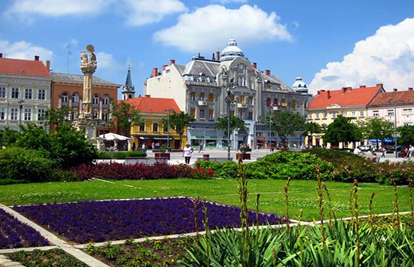
Vas County occupies the farthest west territory of Hungary and borders Austria, Slovenia, and three other Hungarian counties. There is a small Slovenian minority population in this county.
The county seat of Vas is the city of Szombathely, which is the 10th largest city in Hungary and is located near the Austrian border. It is among the oldest cities in all of Hungary and was founded by the Romans in 45 AD.
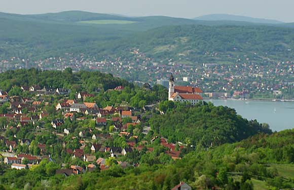
Veszprém
- County Seat: Veszprém
- Total Land Area: 4,464 square kilometers (1,724 square miles)
- Population: 341,317
- Number of Districts: 10
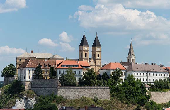
The Hungarian county of Veszprém lies in the west of Hungary and borders six other domestic counties. It has no foreign borders. This county contains almost the entire mountainous Bakony Hills region as well as the northern shore of Lake Balaton.
The county seat of Veszprém goes by the same name as the county, and it is one of the oldest cities in Hungary. It is sometimes referred to as “the city of queens” because the bishop of Veszprém crowned Hungary’s queens for many years.
Zala
- County Seat: Zalaegerszeg
- Total Land Area: 3,784 square kilometers (1,461 square miles)
- Population: 268,648
- Number of Districts: 6
In southwestern Hungary lies Zala, a county that borders Croatia, Slovenia, and three domestic counties. A portion of Lake Balaton, the largest freshwater lake in Central Europe, lies within this county, and the Zala River passes through it.
Zalaegerszeg is the county seat of Zala, and lies along the banks of the Zala River near Hungary’s borders with Slovenia and Austria. Some of the main sights in Zalaegerszeg are its Baroque Roman Catholic church, the old county hall, and the Hevesi Sándor Theater.