Sweden consists of 21 counties.
The counties, many of which were established before the provincial organization law, which was formed in 1810, have undergone a number of changes.
In 1968, the city of Stockholm was included in Stockholm. In 1997, the cities of Kristianstad and Malmöhus were merged and the city of Skåne was established.
On January 1, 1998, the provinces of Göteborg, Bohus, Älvsborg, and Skaraborg were assembled and the province of Västra Götaland was established.
The governorship has two administrative structures, Länsstyrelse and Lansting.
- Länsstyrelse: Works on social issues and regional community planning throughout the province.
- Lansting: Provides health services, education, culture and support to local businesses throughout the county.
Public transport is a service carried out jointly between district administrations and provincial administrations.
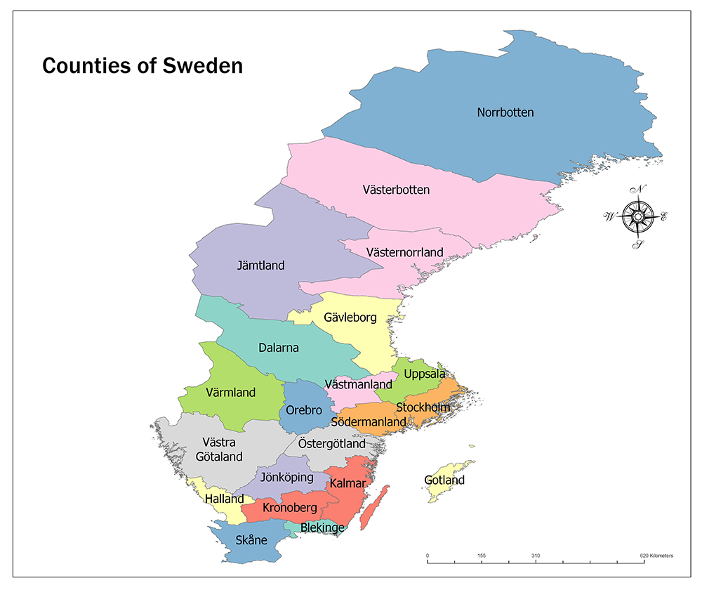
Twenty-One Counties of Sweden
21 Counties of Sweden
The county with the largest area is Norrbotten with 98,244 square kilometers.
The county with the smallest surface area is Blekinge with 2,946 square kilometers.
The most populated region in Sweden is Stockholm, and the least populated province is Gotland.
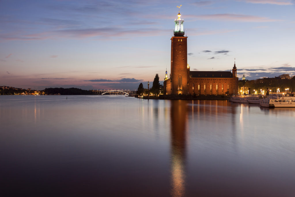
Stockholm
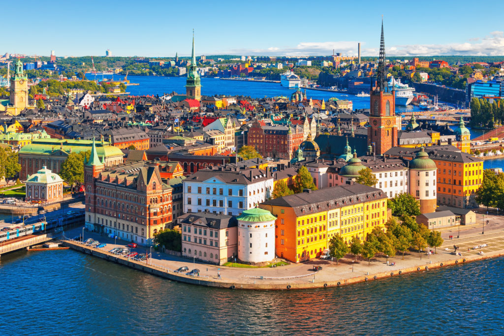
Stockholm County is located on the outskirts of Uppland and Södermanland in the southeastern part of Sweden.
The county on the Baltic Sea also houses Stockholm, the capital of the country. Its neighbors are located in Uppsala and Södermanland. It is also located on the shore of Lake Mälaren.
The population of the region is 2,308,143. More than one-fifth of the country’s population lives in Stockholm. The county has a surface area of 6,519 square kilometers.
Stockholm County was founded in 1714. By January 1, 1968, the county, which was independent of the same city, was merged with Stockholm on that date. On the same date, regulations were made in the width of county borders. Upplands-Bro and the majority of Östhammar were given to Uppsala.
Västerbotten

Västerbotten County is a province in the north of Sweden, located on the Västerbotten, Lapland, and Ångermanland regions. The neighbors of the county include Västernorrland, Jämtland, and Norrbotten. It is also located in the east of Norway, west of Botni Bay. The administrative center of the county is Umeå. Its population is 268,465 and its surface area is 55,401 square kilometers.
Norrbotten
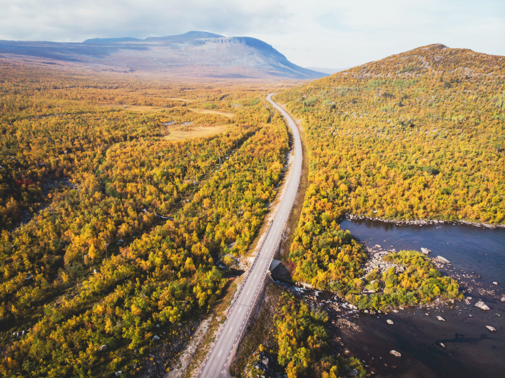
Norrbotten County is located on the northernmost Norrbotten and Lapland regions of Sweden. The only neighbor is Västerbotten and Botni Bay is located in the east.
The county is also a neighbor to Norway and Finland. It is also the only Swedish county to be neighboring Finland. The administrative center of the province is Luleå. The population of the region is 251,295 and its surface area is 98,244 square kilometers.
Uppsala
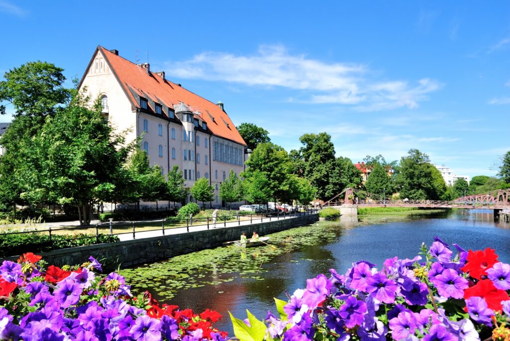
Uppsala County is located on the Uppland district on the eastern side of Sweden. Neighbors include Stockholm, Södermanland, Västmanland, and Gävleborg. To the east is also the Baltic Sea.
The management center is the city of Uppsala. The population of the county is 368,971 and its surface area is 6,989 square kilometers.
Södermanland
Södermanland County is located on the Södermanland district in the southeast of Sweden. Its neighbors include Östergötland, Örebro, Västmanland, Uppsala and Stockholm. Also in the east is the Baltic Sea. The administration center is Nyköping city.
The population of the region is 291,341 and its surface area is 6,061 square kilometers. Södermanland was founded in 1683 by the merger of Nyköping, Gripsholm, and Eskilstunahus.
Östergötland
Östergötland County is located in the Östergötland region in the southeastern region of Sweden. Neighbors include Kalmar, Jönköping, Västra Götaland, Örebro, and Södermanland. The headquarters is Linköping. There is also the coast of the Baltic Sea. The population of the region is 457,496 and its surface area is 10,562 square kilometers.
Jönköping
Jönköping County is located on the Småland region and the Västergötland region in the southern region of Sweden. Neighbors are Halland, Västra Götaland, Östergötland, Kalmar and Kronoberg. The headquarters of the county is Jönköping.
The population of the region is 357,237 and its surface area is 10,475 square kilometers. In Sweden, there are regions with no administrative position. Jönköping County is built on a large part of Småland and the two municipalities of Västergötland. These last two municipalities were added to the county in 1999.
Kronoberg

Kronoberg County is located in the Småland region in the southeastern part of Sweden. Neighbors include Skåne, Halland, Jönköping, Kalmar, and Blekinge. The headquarters is Växjö.
The population of the region is 197,519 and its surface area is 11,171 square kilometers. In 1687, County obtained its borders by leaving the province of Jönköping.
Kalmar

Kalmar County is located in the Småland region in the southeastern part of Sweden and on the Västergötland region. Among its neighbors are Kronoberg, Jönköping, Blekinge, and Östergötland. It is also located in the east of the island of Gotland, and the Baltic Sea. The headquarters is Kalmar.
The population of the region is 243,536 and its surface area is 11,171 square kilometers. Kalmar County was united with Kronoberg County until 1672.
Gotland
Gotland is one of the 25 historic cantons of Sweden. It is also the largest island in the Baltic Sea.
Its population is 58,595. The main sources of income on the island are agriculture and tourism. Limestone production is also carried out. The island was occupied by Danish forces in 1560. The island has been inhabited since prehistoric times.
Blekinge
Blekinge County is an administrative region on the Baltic Sea coast in southern Sweden. Neighbors are Skåne, Kronoberg and Kalmar, and the administrative center is Karlskrona.
The population of the region is 159,371 and its surface area is 2,946 square kilometers.
Skåne
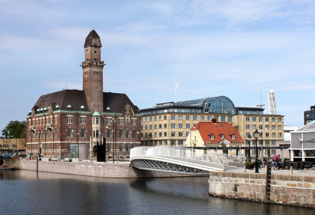
Skåne County is located on the Skåne and Halland districts in the southernmost part of Sweden. Neighbors include Halland, Kronoberg and Blekinge. The headquarters is Malmö, the third largest city in the country.
The population of the region is 1,344,689 and its surface area is 11,034 square kilometers. The county, covering three percent of Sweden’s population and thirteen percent of the population, was founded in 1997 by the merging of Kristianstad County and Malmöhus County.
Halland
Halland County is located on the Halland district on the shores of Kattegat, southwest of Sweden. Neighbors are Västra Götaland, Jönköping, Kronoberg, and Skåne. Halmstad is the headquarters.
The population of the region is 324,825 and its surface area is 5,460 square kilometers. The merging of Halland County with a number of small towns around a larger county is among the issues that the Swedish government is constantly debating today.
Västra Götaland
Västra Götaland County is located on the west coast of Sweden, Västergötland, Bohuslän, and Dalsland. The neighborhoods of Västra Götaland, which has forty-nine sub-municipalities and the second most populous county in Sweden, include Värmland, Örebro, Östergötland, Jönköping, and Halland. It also has its border with Norway, the coast with Vättern and the Vänern Lakes. In addition, the coast of Skagerrak Strait is located in the west.
The population of the region is 1,690,782 and its surface area is 23,948 square kilometers.
Värmland
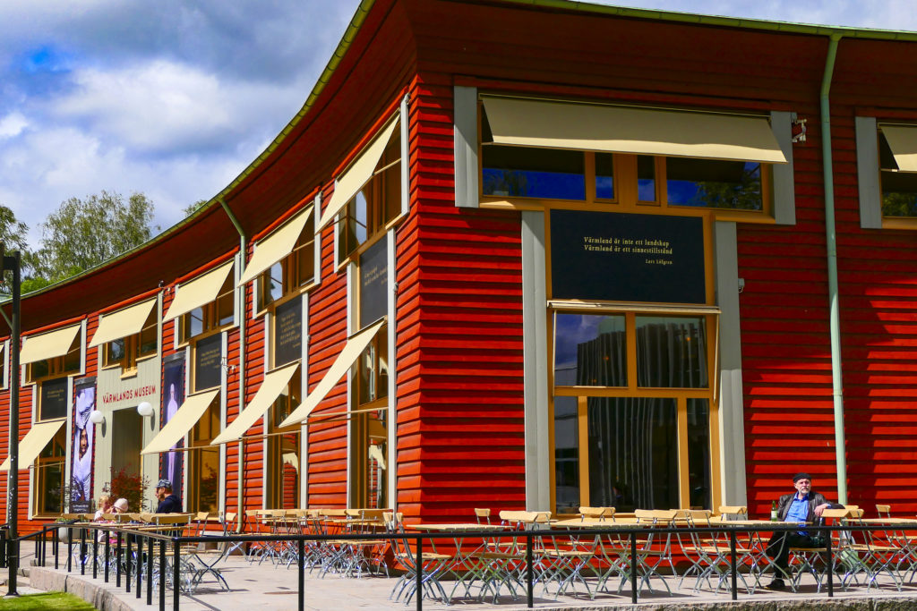
Värmland County is located on the Värmland region in the southwestern belt of Sweden. Its neighbors include Dalarna, Örebro and Västra Götaland. It is also located on the Norwegian border from the west. The headquarters is Karlstad.
The population of the region is 280,399 and the surface area is 17,591 square kilometers.
Örebro
Örebro County is located on the Närke, Västmanland and Värmland regions in the middle belt of Sweden. Neighbors include Västra Götaland, Värmland, Dalarna, Västmanland, Södermanland, and Östergötland. The administration center is Örebro.
The population of the region is 298,907 and the surface area is 8,545 square kilometers. County was named after Närke and Värmland County in 1779 until the occupation of Värmland.
Västmanland

Västmanland County is situated in the Västmanland region in the middle belt of Sweden. Its neighbors are Södermanland, Örebro, Dalarna, and Uppsala. In addition, it has coasts on the third-largest lake of Sweden, Lake Mälaren. The management center is Västerås.
The population of the region is 271,095 and the surface area is 5,145 square kilometers.
Dalarna
Dalarna County is located in the central part of Sweden. Its neighbors are Jämtland, Gävleborg, Västmanland, Örebro and Värmland and Norway. Falun is the headquarters.
The population of the region is 286,165 and its surface area is 28,188 square kilometers. The term Dalarna is used mostly for administrative purposes. The county is located in the Dalarna region, which has the same municipalities.
Gävleborg
Gävleborg County is located in the Gästrikland and Hälsingland regions on the Baltic Sea coast in the east of Sweden. Their neighbors are Uppsala, Västmanland, Dalarna, Jämtland, and Västernorrland. The management center is Gävle.
Its population is 285,637 and its surface area is 18,198 square kilometers.
Västernorrland
Västernorrland County is located on the Ångermanland and Medelpad regions in the north of Sweden. Its neighbors include Gävleborg, Jämtland, and Västerbotte. It is also located on the coast of the Gulf of Botni. The headquarters is Härnösand.
The population of the region is 245,968 and its surface area is 21,683 square kilometers.
Jämtland
Jämtland County is located on the Jämtland region in the central part of Sweden and on the small areas of the Härjedalen region and surrounding areas.
It is the third-largest county in the country, as it covers twelve percent of Swedish territory. Its headquarters are Östersund and its neighbors are Dalarna, Gävleborg, Västernorrland, and Västerbotten. The county also has borders with the west from Norway.
The population of the region is 129,806 and its surface area is 49,341 square kilometers.