The equator is an imaginary line that circles the Earth at the midway point between the North and South Poles. It has a latitude of 0 degrees and separates the Northern Hemisphere from the Southern Hemisphere. The length of the equator is 40,075.16 kilometers.
While the equator is at 0 degrees latitude, northern latitudes increase as they move away from the equator and toward the North Pole, which is 90°; southern latitudes decrease as they move away from the equator and toward the South Pole, which is –90°.
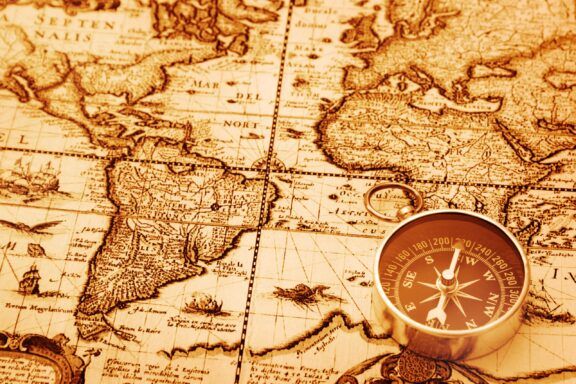
Where is the equator? The equator map below details its location. It shows the line of the equator as it circles the Earth, and the countries on the equator are highlighted in red.

As well as being part of the coordinate system used to determine any point in the world, the equator has the highest linear velocity of any location on Earth due to being the location where the Earth’s circumference is largest. Lines of longitude are also farthest apart at the equator, where they are separated by about 111 kilometers (69 miles). This distance shrinks to zero at the Earth’s poles.
Equatorial regions are defined with the help of the Tropic of Cancer, located 23.4° north of the equator, and the Tropic of Capricorn, located 23.4° south of the equator.
Equator Countries List
Along the equator, the sun’s rays land upon the Earth at a full right angle at noon twice a year. This occurs at the spring and autumn equinoxes in March and September. Days and nights are of equal lengths at the equator because it does not tilt toward or away from the sun’s location throughout the year. The climate along the equator is tropical, resulting in warm weather year-round as well as plenty of rainfall.
Countries that the equator passes through are:
- Gabon
- Congo
- Democratic Republic of Congo
- Uganda
- Kenya
- Somalia
- São Tomé and Príncipe
- Maldives
- Kiribati
- Indonesia
- Ecuador
- Colombia
- Brazil
Equatorial Countries in Asia
In Asia, the equator passes through three countries: the Maldives, Indonesia, and Kiribati, which is in Oceania. These are all island nations, and Indonesia is the largest and most populous of the group by a large margin.
Maldives

The Maldives is a South Asian archipelagic nation in the Indian Ocean made up of 27 atolls. The equator passes through the country, and the Fuvahmulah and Addu Atolls are the only two that are located in the Southern Hemisphere. With a territory of about 90,000 square kilometers (35,000 square miles), the Maldives is the smallest country in Asia.
Fishing and tourism are two large parts of the country’s economy. The Maldives is known for beautiful beaches and for providing luxury tourism services. Millions of tourists visit the nation every year, and there are six Maldivian coral mosques listed as tentative UNESCO World Heritage Sites.
Indonesia
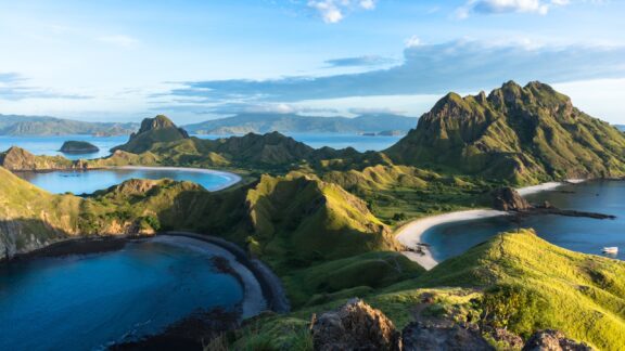
Indonesia is a country in Southeast Asia that is made up of over 17,000 islands, several of which lie directly on the path of the equator. This is the world’s largest archipelagic state and the fourth most populous country in the world. The city of Pontianak, the capital of West Kalimantan, is home to an Equator Monument.
The island of Java, which lies just south of the equator, is the most populous in the country. Indonesia is also the most populous Muslim-majority country in the world. Despite this large population, the country is so vast that it supports a very high level of biodiversity. This biodiversity, along with stunning beaches and excellent surfing on islands like Bali, is part of what makes tourism in Indonesia so popular.
Kiribati

Kiribati is an island country in the central Pacific Ocean and is considered part of Oceania. The 32 atolls that make up Kiribati lie on either side of the equator, and it is the only country in the world that exists in the Northern, Southern, Western, and Eastern Hemispheres.
With few natural resources and an isolated location, Kiribati is one of the least developed nations in the world and has the lowest GDP of any sovereign state in Oceania. International development assistance programs make up some of the country’s economy, as do fishing licenses, transport, and some tourism.
Kiribati is located in the UTC+14:00 timezone, which is the earliest in the world, meaning it is the first timezone to see a new calendar day. Interestingly, this timezone is located directly south of the UTC-10:00 timezone, which is exactly one day behind.
Equatorial Countries in Africa
There are seven countries that are traversed by the equator in Africa. These are Gabon, the Republic of the Congo, the Democratic Republic of Congo, Uganda, Kenya, Somalia, and São Tomé and Príncipe. Sao Tome and Principe is the only African island nation to lie along the equator, and there is a landmark monument on its island of Ilhéu das Rolas.
Gabon

Gabon is a country on Africa’s west coast and is located south of Equatorial Guinea and to the north of the Republic of the Congo. Almost 90% of Gabon is forested, and the country experiences an equatorial climate. Mountains, savanna, and coastal plains also make up the country’s landscape.
With a population of around 2.3 million, Gabon has one of the lowest population densities in Africa. There are over 40 ethnic groups living in Gabon, including roughly 10,000 native French inhabitants, of whom about 2,000 are dual nationals. French is the only official language of Gabon, but the majority of the population speaks an indigenous language.
Republic of the Congo

The Republic of the Congo is a Central African country with a coastline on the Atlantic Ocean. It is located west of the Congo River and is bordered by five countries. The equator crosses the country just north of its middle, and the landscape is made up of mountains, forests, savanna plains, and a coastal plain.
Most of the country’s population of about 5.8 million lives in the southwestern region, leaving large areas of topical jungle in the north uninhabited. Around 70% of the country’s population lives in urban areas like Brazzaville, the capital of the Congo, and Pointe-Noire. Brazzaville is located on the banks of the Congo River, across from Kinshasa in the Democratic Republic of Congo. This is the only place in the world where two national capitals are located on either side of a river within sight of each other.
Democratic Republic of the Congo

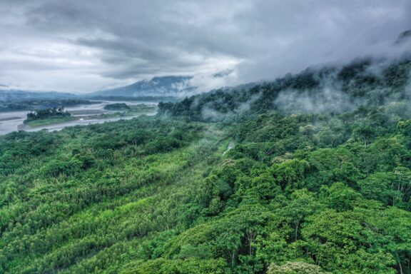
Smaller only than Algeria, the Democratic Republic of the Congo is the second-largest country in Africa. It is located in Central Africa and borders nine different countries. The equator crosses the country and separates its northern third from its southern two-thirds.
The climate in the immediate proximity of the equator experiences very heavy rainfall throughout the year as well as the highest concentration of thunderstorms anywhere on Earth. This climate supports the Congo Rainforest, which is the second largest rainforest in the world after the Amazon.
French is the official and most widely spoken language in the Democratic Republic of the Congo, but about 242 languages are spoken. Four of these languages, Kituba, Lingala, Tshiluba, and Swahili, are considered national languages.
Uganda

Uganda is a landlocked country situated in East Africa that borders five other nations. The capital of Uganda is Kampala, and the equator passes through the country just south of the city. The equator also passes through Lake Victoria, one of the African Great Lakes and the largest lake on the continent.
Full of natural beauty, Uganda is home to 60 protected natural areas and ten national parks, two of which are UNESCO World Heritage Sites: Bwindi Impenetrable National Park and Rwenzori Mountains National Park. There are many different animals living in Uganda, and its parks are home to populations of mountain gorillas, golden monkeys, hippos, and much more.
The economy of Uganda has been consistently growing, and much of its income is generated from product exports as well as the services sector. Its largest product export is coffee, followed by oil and metals. There is also a significant amount of untapped natural gas and crude oil reserves.
Kenya

Kenya is a country in East Africa that borders Somalia, Ethiopia, South Sudan, Uganda, and Tanzania. It also has an Indian Ocean coastline in the southeastern part of the country. The oldest city in Kenya is Mombasa, though the largest city and capital of Kenya is Nairobi.
The equator passes through approximately the center of the country, bisecting it into Northern and Southern Hemisphere sections. Geographically, Kenya is diverse. There are low coastal plains along the Indian Ocean that rise to its central highlands. The Kenyan Highlands are very fertile and make up one of the most productive agricultural areas in Africa.
Because of rapid population growth, Kenya has a very young population, with over 70% of the population under the age of 30. English and Swahili are the country’s national languages, and 69 other languages are also spoken.
Somalia

Somalia is a country in East Africa that contains the continent’s easternmost point and has the longest coastline of any country on the African mainland. The country extends into the Arabian Sea, forming the Somali Peninsula, also known as the Horn of Africa.
The equator crosses the southern tip of Somalia, and the country’s proximity to the equator means that its climate doesn’t vary greatly throughout the year. The country is mostly desert and features a warm desert climate in the north and a warm semi-arid desert climate in a region of the south.
Roughly 85% of Somalia’s population is ethnic Somali, and other non-Somali ethnic groups such as Bravanese, Bantus, and Ethiopians live in the southern regions of the country.
São Tomé and Príncipe

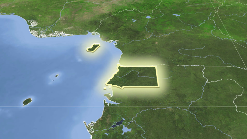
São Tomé and Príncipe is the only island nation of Africa that the equator passes through. It is located in the Gulf of Guinea off the western coast of Central Africa, and the closest mainland country is Gabon. The country consists of two small archipelagos, each surrounding the island of São Tomé or Príncipe.
The country has a population of close to 200,000 which makes it the second-least populous country in Africa. It’s also the second smallest. Economically, plantation agriculture has been the most important industry in the country since the 19th century. While large amounts of cocoa are exported each year, the country must import the vast majority of its food needs.
Equatorial Countries in South America
In South America, the equator passes through three countries: Ecuador, Colombia, and Brazil.
Ecuador

What’s in a name? No, it’s no coincidence that the name Ecuador looks a whole lot like “equator.” Ecuador’s official name is República del Ecuador, which translates to “Republic of the Equator.” The equator runs through the northern portion of the country, just north of Quito. There is even a great monument about 45-minutes away from Quito where you can stand in both the Northern and Southern Hemispheres at the same time.
While it’s common knowledge that Mount Everest is the tallest mountain on Earth, it’s not actually the point on the globe that extends furthest into the atmosphere. This is due to the fact that the Earth is not a perfect sphere.
Due to the rotation of the world, the Earth swells slightly at the equator. This global bulge is responsible for the extra 1.5 miles Mount Chimborazo in Ecuador has on Mount Everest when measuring from the center of the Earth. However, mountain peaks are measured with reference to sea level, and with this in mind, Mount Everest is significantly taller. This is because the seas around the equator are also more elevated.
Colombia

Located in northwestern South America, the equator passes through the southern end of Colombia. Colombia is the only country in South America to have coastlines and islands on both the Pacific and Atlantic Oceans. The country’s territory has been inhabited by various indigenous peoples since around 12,000 BCE or longer. Today, the official language of the country is Spanish, but over 70 languages are spoken.
The landscape in Colombia includes parts of the Amazon rainforest, highlands, grasslands, and deserts. This diversity in geography is partly responsible for the country having the second-highest biodiversity of any in the world. It’s also considered one of the world’s 17 megadiverse countries.
Brazil

Brazil is the fifth-largest country in the world and the largest in South America, so perhaps it’s no wonder the equator passes through it. In fact, the country is so long from north to south that it is the only one in the world to have both the equator and the Tropic of Capricorn running through it.
The capital of Brazil is Brasília, though the two most populous cities in Brazil are São Paulo and Rio de Janeiro. Brazil’s economy is the largest in South America and is diversified among agriculture, industry, and many services. Ecotourism is also popular in the country, and the tourism sector in general is growing, as there are many things to do in Brazil.
Due to many years of mass immigration, Brazil has one of the most multicultural and diverse populations in the world. The official language in the country is Portuguese, which makes it the largest Lusophone country in the world and the only one in the Americas.
Equatorial Guinea and the Equator
It’s tempting to think that the country of Equatorial Guinea lies along the equator, but its name actually refers to its proximity to the equator. The country lies approximately 100 kilometers (68.4 miles) north of the equator along the Gulf of Guinea in eastern Africa. Due to its closeness to the equator, the country has a similar climate to other equatorial countries.
Geodesy of Equator
The equator is an imaginary line that divides the world in two and is determined by geodetic calculations. It is 40,075 kilometers long and is 0° latitude.
Equator Location
The exact position of the equator is not fixed because the equatorial plane is perpendicular to the axis of rotation of the Earth, which drifts about 2.7 meters (9 feet) a year. This an effect that has to be accounted for with detailed geophysical measurements.
Equator Length
In two commonly used geodesic standards, the equator is modeled as a circle with an integer radius in meters. In 1976, the International Astronomical Union chose a radius of 6,378,140 kilometers (IAU-1976). The International Union of Geodesy and Geophysics later revised this to 6,378,137 kilometers in the World Geodetic System (WGS-84).
Despite this change, the newer IAU-2000 has retained the former IAU-1976 value. If it were truly circular, the equator would be exactly 2π times the radius, 40.075.036 kilometers in length. However, due to the impact of tides on the surface of the Earth, the actual length of the equator is about 40,075.16 kilometers.
Equator Climate and Seasons
Seasons are a result of the fact that the Earth’s axis is tilted relative to the plane of its revolution around the Sun. During the year, the northern and southern hemispheres take turns being tilted toward the sun. When a hemisphere is tilted toward the sun, it receives sunlight at a more direct angle and sees more hours of sunlight. This is what happens during a hemisphere’s summer months.
Conversely, the half of the Earth that is tilted away from the Sun receives light at more of an indirect angle and gets fewer hours of sunlight. This is known as winter.
The equator passes through three major oceans: the Atlantic Ocean, the Indian Ocean, and the Pacific Ocean. Although there are dramatic differences in rain and humidity around the equator, there is little change in temperature throughout the year.
Unlike locations further from the equator, there are generally not four seasons in close proximity to the equator. Equatorial climates are typically warm and see a great deal of rainfall. The seasons are often classified as wet and dry in this region. Although temperatures are generally high, the high amount of precipitation means that they aren’t the hottest in the world.
The average annual temperatures in the equatorial plains are around 22 °C to 27 °C. There are about 200 rainy days a year and the annual solar hours are around 2,000.
Despite warm year-round temperatures at sea level, there are some tropical glaciers at high altitudes like Mount Andes and Mount Kilimanjaro near the equator. The highest point on the equator is the 4,690-meter peak on the southern slopes of the Volcán Cayambe. This is also the only region directly along the equator that experiences snowfall.
Equinox dates are the starting dates of the spring and autumn seasons for the world’s two hemispheres. On these dates, the sun’s rays fall down at a perpendicular angle to the equator and herald the beginning of a new season for the hemispheres.
What is an Equinox?
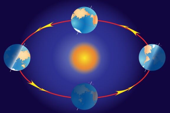
In addition to orbiting the Sun, the Earth rotates around its own axis, which is tilted in relation to its orbital path. These phenomena are responsible for the experiences of night, day, and seasons. There are a few dates throughout the year that are especially important in relation to the seasons and the position of the Earth around the Sun.
Two of these important dates are the equinoxes. One equinox happens between March 19 to 21 every year and marks the beginning of spring in the Northern Hemisphere and autumn in the Southern Hemisphere. The second equinox occurs between September 21 to 24 and marks the onset of autumn in the Northern Hemisphere and spring in the Southern Hemisphere.
As well as marking the beginning of seasons, these dates are when the sun’s rays land vertically upon the equator at a 90-degree angle. It is also during the equinoxes that day and night are of equal length in all parts of the world.
Image Sources and Copyright Information
- Colorful Cityscape of Guayaquil, Ecuador: © Jess Kraft/Shutterstock